Connecticut

Home / Locations / Connecticut
  • Air Line Trail & Mashamoquet Brook

    Today’s Forecast: Today’s Report: About Air Line Trail & Mashamoquet Brook The representative point supports planning for rail-trail washouts, mud, bridge ice, campground season, brook flow and fishing access. Planning the Day Use firm rail-trail segments instead of eroded brookside paths after rain; shorten the ride when heat or thunderstorms make open causeways uncomfortable. Weather…

  • Bear Mountain & Northwest Corner

    Today’s Forecast: Today’s Report: About Bear Mountain & Northwest Corner The representative point supports planning for summit wind, early frost, trail ice, remote access and regulated lake or stream fishing. Planning the Day Move from the exposed summit approach to a lower wooded walk when wind or lightning builds; use only designated legal campsites with…

  • Bigelow Hollow & Nipmuck State Forest

    Today’s Forecast: Today’s Report: About Bigelow Hollow & Nipmuck State Forest The representative point supports planning for lake drawdowns, launch status, cold water, remote access and permit-based backcountry camping. Planning the Day Use Bigelow Hollow for day use and launch access; camping is limited to designated Nipmuck backcountry sites with reservations or permits, without drive-up…

  • Bluff Point, Haley Farm & Mystic–Stonington

    Today’s Forecast: Today’s Report: About Bluff Point, Haley Farm & Mystic–Stonington The representative point supports planning for cove versus exposed-water wind, tide, fog, harbor traffic, cold water and trail flooding. Planning the Day Use Poquonock Cove or a land trail instead of an exposed crossing when visibility or small-craft wind deteriorates; route bikes around flooded…

  • Kent Falls & Macedonia Brook

    Today’s Forecast: Today’s Report: About Kent Falls & Macedonia Brook The representative point supports planning for waterfall flow, slippery stone, campground season, stream temperature and steep trail drainage. Planning the Day Choose Macedonia’s lower forest trails instead of waterfall stairs or exposed ledges when heavy rain, ice or lightning raises risk. Weather and Access Tips…

  • Lake Waramaug & Litchfield Hills

    Today’s Forecast: Today’s Report: About Lake Waramaug & Litchfield Hills The representative point supports planning for carry-in launch capacity, vessel inspections, horsepower rules, lake wind, water quality, campground access and golf conditions. Planning the Day Use a paddlecraft or shore plan if motor-equipped car-top inspection hours, the nonresident limit or parking prevents launching; move golf…

  • Mohawk Mountain & State Forest

    Today’s Forecast: Today’s Report: About Mohawk Mountain & State Forest The representative point supports planning for ski-area snowmaking and lifts versus natural-snow forest travel, ridge wind and separate operating rules. Planning the Day Use the private ski area’s posted lift and slope status for downhill plans; natural-snow cross-country skiing in the state forest is separate,…

  • New Haven Harbor & Milford Beaches

    Today’s Forecast: Today’s Report: About New Haven Harbor & Milford Beaches The representative point supports planning for tide, tombolo current, harbor wind, fog, coastal flooding, water quality and marina access. Planning the Day Do not cross the Charles Island tombolo as flood tide covers it; substitute a harborfront ride or shore plan when visibility, current…

  • Pachaug State Forest & Hopeville Pond

    Today’s Forecast: Today’s Report: About Pachaug State Forest & Hopeville Pond The representative point supports planning for forest-road condition, campground season, fire danger, pond water quality, launch access and thunderstorms. Planning the Day Choose a shorter forest road loop when trails are saturated; use shore-based recreation if pond wind, algae or lightning makes paddling unsuitable….

  • Powder Ridge Mountain Park

    Today’s Forecast: Today’s Report: About Powder Ridge Mountain Park The representative point supports planning for snowmaking, slope and lift status, rain, icing, wind, mountain-bike trail drying and scheduled programs. Planning the Day Use posted ski or bike operations rather than inferring availability from nearby weather; replace muddy riding with an open hard-surface or programmed activity….

  • Quinebaug & Shetucket Rivers

    Today’s Forecast: Today’s Report: About Quinebaug & Shetucket Rivers The representative point supports planning for reach-specific access, upstream rainfall, dams, low-head hazards, debris, flood stage and limited lower-river tidal influence. Planning the Day Choose a documented public reach whose flow matches the paddler’s skill; do not assume continuous navigation or access, and delay downstream launches…

  • Rocky Neck & Connecticut River Estuary

    Today’s Forecast: Today’s Report: About Rocky Neck & Connecticut River Estuary The representative point supports planning for river discharge, tide, wind-against-current chop, fog, cold water, coastal flooding and campground season. Planning the Day Stay ashore when ebb current opposes strong Sound wind; choose a protected estuary reach only when tide, flow, visibility and public access…

  • Sleeping Giant & West Rock Ridge

    Today’s Forecast: Today’s Report: About Sleeping Giant & West Rock Ridge The representative point supports planning for ridge heat, lightning, trail erosion, wet leaves, parking and route-specific cycling access. Planning the Day Use only paved roads, greenways or officially designated multiuse routes for biking; Blue-Blazed trails are foot travel only, and a paved option is…

  • Stamford & Greenwich Shoreline

    Today’s Forecast: Today’s Report: About Stamford & Greenwich Shoreline The representative point supports planning for urban heat, western Sound tide, harbor traffic, fog, coastal flooding, air quality and golf delays. Planning the Day Use a protected harbor or land-based plan instead of open Sound water when chop builds; shift tee times away from frost, saturated…

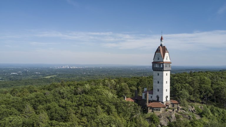
  • Talcott Mountain & Farmington Valley

    Today’s Forecast: Today’s Report: About Talcott Mountain & Farmington Valley The representative point supports planning for ridge wind, tower access, thunderstorms, natural-surface trail condition, golf frost and drainage. Planning the Day Move from the exposed ridge to a lower paved valley route when lightning or wind builds; shift tee times for frost, saturated turf or…