Today’s Forecast:
☀
93°F
Current Temperature
Mostly Clear
⚠️
Extreme Heat Warning
Extreme Heat Warning issued July 25 at 4:30PM CDT until July 26 at 8:00PM CDT by NWS Sioux Falls SD (Expires: July 26, 2026 8:00 pm)
Show Alert Details & Instructions
Description:
* WHAT...Dangerously hot conditions with heat index values up to 115.
* WHERE...Portions of south central and southeast South Dakota.
* WHEN...Until 8 PM CDT Sunday.
* IMPACTS...Heat related illnesses increase significantly during
extreme heat and high humidity events.
Instructions:
Drink plenty of fluids, stay in an air-conditioned room, stay out of
the sun, and check up on relatives and neighbors.
Do not leave young children and pets in unattended vehicles. Car
interiors will reach lethal temperatures in a matter of minutes.
Take extra precautions when outside. Wear lightweight and loose
fitting clothing. Try to limit strenuous activities to early morning
or evening. Take action when you see symptoms of heat exhaustion and
heat stroke.
To reduce risk during outdoor work, the Occupational Safety and
Health Administration recommends scheduling frequent rest breaks in
shaded or air conditioned environments. Anyone overcome by heat
should be moved to a cool and shaded location. Heat stroke is an
emergency! Call 9 1 1.
⚠️
Severe Thunderstorm Watch
Severe Thunderstorm Watch issued July 25 at 3:36PM CDT until July 25 at 11:00PM CDT by NWS Sioux Falls SD (Expires: July 25, 2026 11:00 pm)
Show Alert Details & Instructions
Description:
THE NATIONAL WEATHER SERVICE HAS ISSUED SEVERE THUNDERSTORM WATCH
513 IN EFFECT UNTIL 11 PM CDT THIS EVENING FOR THE FOLLOWING
AREAS
IN SOUTH DAKOTA THIS WATCH INCLUDES 24 COUNTIES
IN CENTRAL SOUTH DAKOTA
JERAULD
IN EAST CENTRAL SOUTH DAKOTA
BEADLE BROOKINGS KINGSBURY
LAKE MINER MOODY
SANBORN
IN SOUTH CENTRAL SOUTH DAKOTA
AURORA BRULE CHARLES MIX
DOUGLAS GREGORY
IN SOUTHEAST SOUTH DAKOTA
BON HOMME CLAY DAVISON
HANSON HUTCHINSON LINCOLN
MCCOOK MINNEHAHA TURNER
UNION YANKTON
THIS INCLUDES THE CITIES OF ALCESTER, ALEXANDRIA, ALPENA,
ARLINGTON, ARMOUR, AVON, BERESFORD, BRIDGEWATER, BROOKINGS,
BURKE, CANISTOTA, CANTON, CENTERVILLE, CHAMBERLAIN, CHANCELLOR,
CLAYTON, CORSICA, DE SMET, DELMONT, ELK POINT, EMERY, FLANDREAU,
FREEMAN, GREGORY, HARRISBURG, HOWARD, HURLEY, HURON, IRENE,
JEFFERSON, KIMBALL, LAKE ANDES, LAKE PRESTON, LENNOX, MADISON,
MARION, MARTY, MENNO, MITCHELL, MONTROSE, NORTH SIOUX CITY,
ORLAND, PARKER, PARKSTON, PLANKINTON, PLATTE, SALEM, SCOTLAND,
SIOUX FALLS, SPRINGFIELD, STICKNEY, TABOR, TEA, TRIPP, TYNDALL,
VERMILLION, VIBORG, WAGNER, WESSINGTON SPRINGS, WHITE LAKE,
WOONSOCKET, AND YANKTON.
Tonight:Showers and thunderstorms likely after 8pm. Some of the storms could be severe. Mostly cloudy, with a low around 74. Heat index values as high as 114. South southeast wind 10 to 15 mph. Chance of precipitation is 60%. New rainfall amounts less than a tenth of an inch possible.
Sunday:Mostly sunny, with a high near 100. Heat index values as high as 110. South wind 10 to 15 mph, with gusts as high as 25 mph.
Sunday Night:Mostly clear, with a low around 72. Heat index values as high as 109. Southwest wind 5 to 10 mph.
Today’s Report:
Not Recommended for outdoor events / activities. High near 99°F. Low rain risk (13%). Breezy winds (15 mph). Hot temperatures (high near 99°F). Slight chance of thunderstorms. Temperatures outside comfort limits (99°F).
-
Temp: Unfavorable weather factor
-
Rain: Favorable conditions
-
Wind: Marginal weather factor
-
Heat: Marginal weather factor
-
Thunderstorm: Marginal weather factor
-
Alert: Unfavorable weather factor
⚠️ Active weather alerts affect this activity!
Tomorrow's Outlook:
Not Recommended
6/100
Not Recommended for biking. High near 99°F. Low rain risk (13%). Breezy winds (15 mph). Hot temperatures (high near 99°F). Slight chance of thunderstorms. Temperatures outside comfort limits (99°F).
-
Temp: Unfavorable weather factor
-
Rain: Favorable conditions
-
Wind: Marginal weather factor
-
Heat: Marginal weather factor
-
Thunderstorm: Marginal weather factor
-
Alert: Unfavorable weather factor
-
Alert: Unfavorable weather factor
⚠️ Active weather alerts affect this activity!
Tomorrow's Outlook:
Not Recommended
6/100
Not Recommended for camping. High near 99°F. Low rain risk (13%). Breezy winds (15 mph). Hot temperatures (high near 99°F). Slight chance of thunderstorms. Temperatures outside comfort limits (99°F).
-
Temp: Unfavorable weather factor
-
Rain: Favorable conditions
-
Wind: Marginal weather factor
-
Heat: Marginal weather factor
-
Thunderstorm: Marginal weather factor
-
Alert: Unfavorable weather factor
-
Alert: Unfavorable weather factor
⚠️ Active weather alerts affect this activity!
Tomorrow's Outlook:
Not Recommended
6/100
About Mitchell
Mitchell is a southeast South Dakota road-trip and event hub with parks, bike routes, campgrounds, lakeside stops, and family-friendly attractions.
Make the Most of a Mitchell Day
Use Mitchell as a flexible base for open prairie drives, park time, campground nights, or nearby lake stops depending on wind, heat, and storm timing.
Weather Tips for Mitchell
- Prairie wind, hot summer afternoons, lightning, and exposed campground conditions can shape the best version of a Mitchell day.
- If thunder is in the forecast, prioritize exposed parks, event grounds, and longer trail routes early.
- For campground days, check overnight lows, storm timing, wet ground, and how quickly shelter is available.
- Strong prairie wind can change comfort quickly, especially in open parks, campgrounds, and event spaces.
Nearby Towns and Areas
This page can also be useful when planning outdoor time near:
- Mitchell
- Lake Mitchell
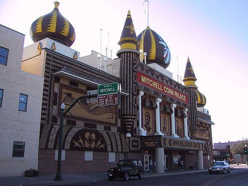
- Corn Palace area
- Dakota Discovery Museum
- Hitchcock Park
- Plankinton routes
Plan Around the Conditions
Use the forecast to choose the best version of Mitchell rather than forcing one itinerary. Match wind, rain timing, temperature, storms, water conditions, trail surfaces, and road conditions to the activity that gives your group the most comfortable day.
7-Day Forecast for Mitchell