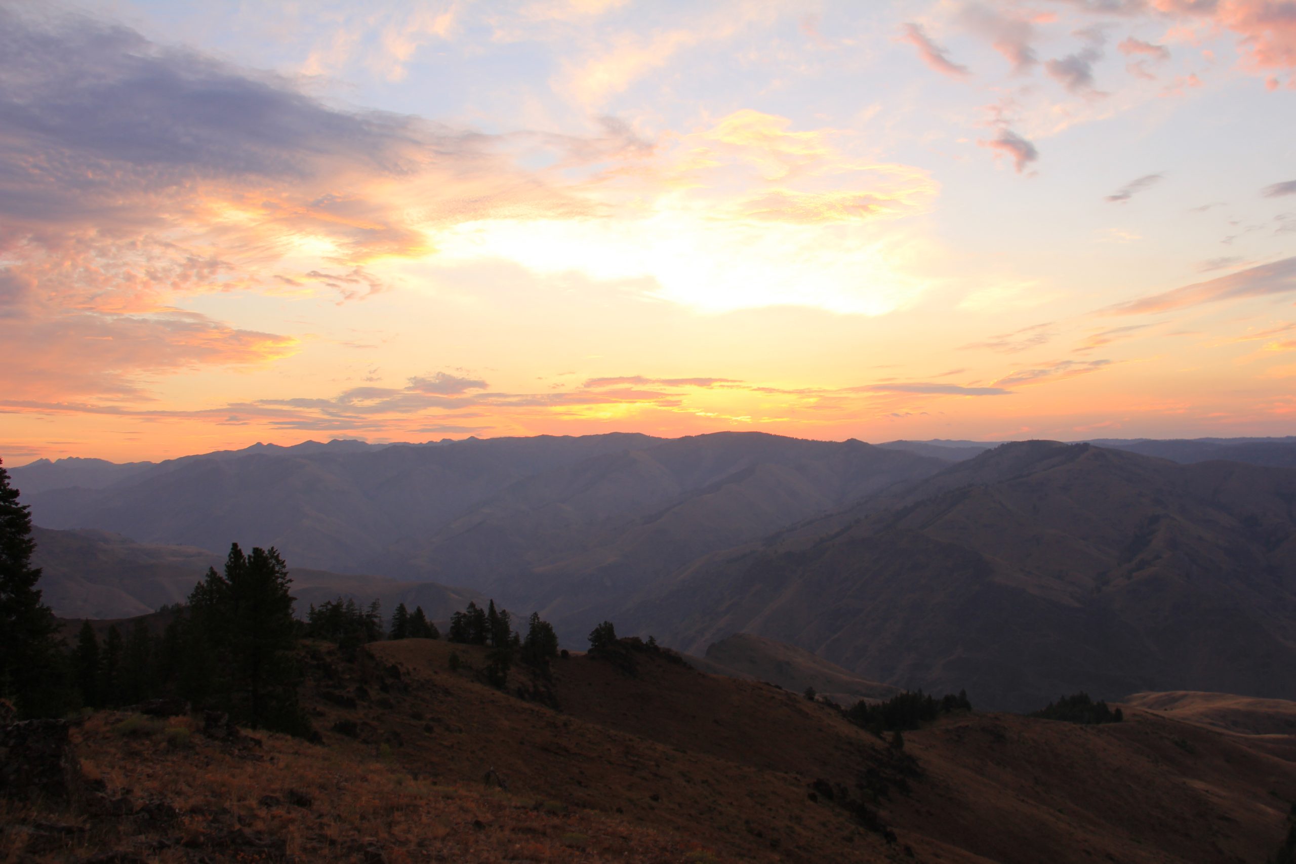
Hells Canyon National Recreation Area

Home / Locations / Idaho / Hells Canyon National Recreation Area
Hells Canyon National Recreation Area landscape

Today’s Forecast:

86°F
Current Temperature
Clear
Station: KMYL
Observed at: 5:05 pm
Wind: 9 mph | Humidity: 18%
⚠️
Air Quality Alert
Air Quality Alert issued July 27 at 12:38PM MDT by NWS Boise ID (Expires: July 29, 2026 2:00 pm)
Show Alert Details & Instructions
Description: * WHAT...Air Quality Advisory because of degraded air quality due to wildfire smoke. Air Quality Index is forecast to be Very Unhealthy. * WHERE...Ada, Adams, Boise, Canyon, Elmore, Gem, Owyhee, Payette, Valley, and Washington Counties. * WHEN...UNTIL 3 PM MDT FRIDAY. * IMPACTS...Health warnings of emergency conditions. The entire population is more likely to be affected. Instructions: Air pollutants can cause breathing difficulties for children, the elderly, as well as persons with respiratory problems. Those individuals who are sensitive to increased particulate matter or smoke are encouraged to avoid prolonged or strenuous outdoor activity during this advisory. Open burning is prohibited by air quality rule. It is also recommended that all other individuals limit prolonged or strenuous activity outdoors. THIS STATEMENT IS ISSUED BY THE IDAHO DEPARTMENT OF ENVIRONMENTAL QUALITY, AIR QUALITY GROUP FOR MORE INFORMATION, CONTACT DEQ's Boise Regional Office at (208) 373-0550
⚠️
Air Quality Alert
Air Quality Alert issued July 27 at 10:32AM MDT by NWS Boise ID (Expires: July 29, 2026 2:00 pm)
Show Alert Details & Instructions
Description: * WHAT...Air Quality Advisory because of degraded air quality due to wildfire smoke. Air Quality Index is forecast to be Unhealthy. * WHERE...Ada, Adams, Boise, Canyon, Elmore, Gem, Owyhee, Payette, Valley, and Washington Counties. * WHEN...UNTIL 2 PM MDT TUESDAY. * IMPACTS...Everyone may begin to experience health effects; members of sensitive groups may experience more serious health effects. Instructions: Air pollutants can cause breathing difficulties for children, the elderly, as well as persons with respiratory problems. Those individuals who are sensitive to increased particulate matter or smoke are encouraged to avoid prolonged or strenuous outdoor activity during this advisory. Open burning is prohibited by air quality rule. It is also recommended that all other individuals limit prolonged or strenuous activity outdoors. THIS STATEMENT IS ISSUED BY THE IDAHO DEPARTMENT OF ENVIRONMENTAL QUALITY, AIR QUALITY GROUP FOR MORE INFORMATION, CONTACT DEQ's Boise Regional Office at (208) 373-0550
⚠️
Air Quality Alert
Air Quality Alert issued July 27 at 9:10AM MDT by NWS Boise ID (Expires: July 29, 2026 2:00 pm)
Show Alert Details & Instructions
Description: * WHAT...Air Quality Advisory because of degraded air quality due to wildfire smoke. Air Quality Index is forecast to be Unhealthy. * WHERE...Ada, Adams, Boise, Canyon, Elmore, Gem, Owyhee, Payette, Valley, and Washington Counties. * WHEN...UNTIL 2 PM MDT TUESDAY. * IMPACTS...Everyone may begin to experience health effects; members of sensitive groups may experience more serious health effects. Instructions: Air pollutants can cause breathing difficulties for children, the elderly, as well as persons with respiratory problems. Those individuals who are sensitive to increased particulate matter or smoke are encouraged to avoid prolonged or strenuous outdoor activity during this advisory. Open burning is prohibited by air quality rule. It is also recommended that all other individuals limit prolonged or strenuous activity outdoors. THIS STATEMENT IS ISSUED BY THE IDAHO DEPARTMENT OF ENVIRONMENTAL QUALITY, AIR QUALITY GROUP FOR MORE INFORMATION, CONTACT DEQ's Boise Regional Office at (208) 373-0550
This Afternoon:Areas of smoke. Sunny, with a high near 77. West wind around 9 mph.
Tonight:Areas of smoke. Mostly clear, with a low around 58. North wind 8 to 13 mph, with gusts as high as 23 mph.
Tuesday:Areas of smoke. Sunny, with a high near 81. Northwest wind 6 to 9 mph.

Today’s Report:

🛶 Paddling

Use Caution
  48 /100

Use Caution for paddling. High near 77°F. Breezy winds (12 mph). Smoke or haze in forecast.

  • Temp: Favorable conditions
  • Rain: Favorable conditions
  • Wind: Marginal weather factor
  • Smoke: Marginal weather factor
  • Thunderstorm: Favorable conditions
Tomorrow's Outlook:
Use Caution 45/100
Use Caution for paddling. High near 81°F. Breezy winds (16 mph). Smoke or haze in forecast.

Camping

Use Caution
  48 /100

Use Caution for camping. High near 77°F. Light wind (12 mph). Smoke or haze in forecast.

  • Temp: Marginal weather factor
  • Rain: Favorable conditions
  • Wind: Favorable conditions
  • Smoke: Marginal weather factor
  • Thunderstorm: Favorable conditions
Tomorrow's Outlook:
Use Caution 47/100
Use Caution for camping. High near 81°F. Breezy winds (16 mph). Smoke or haze in forecast.

🥾 Hiking

Use Caution
  48 /100

Use Caution for hiking. High near 77°F. Light wind (12 mph). Smoke or haze in forecast.

  • Temp: Marginal weather factor
  • Rain: Favorable conditions
  • Wind: Favorable conditions
  • Smoke: Marginal weather factor
  • Thunderstorm: Favorable conditions
Tomorrow's Outlook:
Use Caution 47/100
Use Caution for hiking. High near 81°F. Light wind (16 mph). Smoke or haze in forecast.

🎪 Outdoor Events / Activities

Use Caution
  49 /100

Use Caution for outdoor events / activities. High near 77°F. Light wind (12 mph). Smoke or haze in forecast.

  • Temp: Favorable conditions
  • Rain: Favorable conditions
  • Wind: Favorable conditions
  • Smoke: Marginal weather factor
  • Thunderstorm: Favorable conditions
Tomorrow's Outlook:
Use Caution 48/100
Use Caution for outdoor events / activities. High near 81°F. Breezy winds (16 mph). Smoke or haze in forecast.

About Hells Canyon National Recreation Area

Hells Canyon National Recreation Area is an Idaho destination for a major national recreation destination with river flow, canyon heat, remote access, wildfire smoke, elevation, and camping concerns.

Make the Most of a Hells Canyon National Recreation Area Day

Match the route, launch, facility, or turnaround time to wind, precipitation, temperature, smoke, water, snow, road access, and daylight. Keep a shorter or more sheltered backup ready.

Weather Tips for Hells Canyon National Recreation Area

  • Check official access notices, alerts, road or trail conditions, fire restrictions, and local forecasts before leaving.
  • Check river flow, reservoir wind, cold-water conditions, waves, lightning, and verified local ice reports before water plans; no forecast alone proves that ice is safe.
  • Carry layers, water, navigation, sun protection, and seasonal traction or flotation appropriate to the activity.
  • Allow extra time for remote roads, mountain passes, wildfire smoke, spring runoff, and limited winter daylight.

Nearby Towns and Areas

This page can also be useful when planning outdoor time near:

  • Riggins
  • White Bird
  • Pittsburg Landing
  • Seven Devils Mountains
  • Snake River
  • Hells Canyon Dam
  • Nez Perce National Forest

Plan Around the Conditions

Choose the safest version of a Hells Canyon National Recreation Area day by matching the activity to current wind, precipitation, temperature, smoke, water or snow conditions, access, and daylight.

7-Day Forecast for Hells Canyon National Recreation Area

86°F
Current Temperature
Clear
Station: KMYL
Observed at: 5:05 pm
Wind: 9 mph | Humidity: 18%
Mon 🌫
77° 58°
0%
Tue 🌫
81° 59°
0%
Wed 🌫
81° 60°
0%
Thu 🌫
82° 61°
0%
Fri
83° 63°
0%
Sat
84° 58°
0%
Sun
73° 51°
0%

7-Day High Temperature Trend

77° Mon 81° Tue 81° Wed 82° Thu 83° Fri 84° Sat 73° Sun

7-Day Low Temperature Trend

58° Mon 59° Tue 60° Wed 61° Thu 63° Fri 58° Sat 51° Sun

📊 7-Day Outdoor Outlook

Good Fair Poor 47 Mon 12 Tue 12 Wed 12 Thu 20 Fri 20 Sat 100 Sun
Forecast data from the National Weather Service  |  Last Updated: July 27, 2026 5:57 pm CDT

Hells Canyon National Recreation Area Weather by Season

Winter

Winter at Hells Canyon National Recreation Area can bring snow, ice, wind, short daylight, and rapidly changing road or trail access.

Spring

Spring brings freeze-thaw mud, snowmelt, high rivers, cold water, and lingering mountain snow. Lower routes usually open well before high passes and backcountry trailheads.

Summer

Summer usually offers the broadest access, but dry heat, thunderstorms, lightning, wildfire smoke, fire restrictions, reservoir wind, and cold mountain water can alter plans.

Fall

Fall brings cooler air, shorter daylight, hunting-season awareness, and early snow at elevation. Confirm seasonal services and allow extra travel time on remote roads.

Key Climate Data Points

  • Annual average temperature: around 51–57°F, using the relevant local and elevation context.
  • Annual snowfall: usually 5–20 inches at river level, while high rims receive much more.
  • Warmest months: July and August are normally warmest.
  • Coolest months: December and January are typically coolest.
  • Wettest season: winter and spring usually provide the greatest mountain precipitation, with local variation.
  • Driest season: midsummer is generally driest, despite isolated thunderstorms.
  • Best outdoor window: June through October for warm-season access, with midwinter best at established winter destinations.