
Pictured Rocks & Munising, MI
Today’s Forecast:
🧐 Adventure Bingo Game
Download the outdoor adventure Bingo game to keep kids engaged in the outdoors.
Today’s Report:
Hiking
Excellent for hiking. High near 70°F. Low rain risk (1%).
- Temp: Favorable conditions
- Rain: Favorable conditions
- Wind: Favorable conditions
- Thunderstorm: Favorable conditions
Paddling
Excellent for paddling. High near 70°F. Low rain risk (1%).
- Temp: Favorable conditions
- Rain: Favorable conditions
- Wind: Favorable conditions
- Thunderstorm: Favorable conditions
Camping
Excellent for camping. High near 70°F. Low rain risk (1%).
- Temp: Favorable conditions
- Rain: Favorable conditions
- Wind: Favorable conditions
- Thunderstorm: Favorable conditions
Fishing
Excellent for fishing. High near 70°F. Low rain risk (1%).
- Temp: Favorable conditions
- Rain: Favorable conditions
- Wind: Favorable conditions
- Thunderstorm: Favorable conditions
About Pictured Rocks & Munising
Pictured Rocks & Munising is one of the Upper Peninsula’s most weather-sensitive outdoor destinations, with Lake Superior cliffs, beaches, waterfalls, forests, campgrounds, and boat or paddle routes close together. Conditions on Lake Superior can change quickly, and cold water is a serious planning factor even in warm weather. This page should help you decide when to hike, paddle with appropriate guidance, camp, or choose a safer inland waterfall day.
Make the Most of a Pictured Rocks & Munising Day
Start with the marine forecast, wind direction, wave height, and thunderstorm chances before choosing any water plan. Calm periods are best for shoreline viewing, boat tours, and experienced paddling with proper local guidance, while windy or stormy days are better for waterfalls, forest trails, and town stops. Keep hikes realistic because cliff-top and beach routes can be exposed.
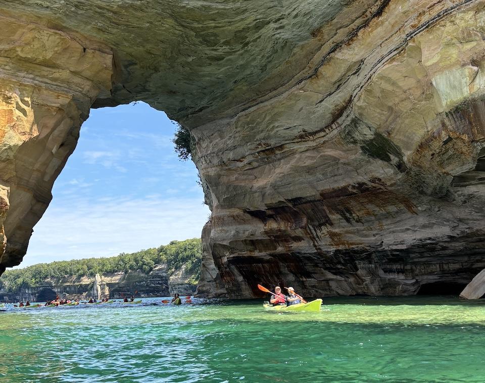
Taking a kayak tour in Munising is a good idea. The guides will take you through each area, explaining it, and even taking memorable photographs. Ask your guide to roll their kayak and see if they can do it.
Probably the best beach to visit is Sand Point Beach, but there are many other beaches around – some with longer hikes involved.
You can also bike or hike Grand Island. Biking can take anywhere from 3-5 hours to complete (on the higher end if you make stops). Start on the west side, going up – clockwise – because that side a bit more technical, and it’s better to end on something easier than more difficult when you’re low on energy. The ferry comes at the top of each hour until 6 pm in the summer.
Make sure you get a pasty before leaving town. There’s a local pizza shop that also makes good pizza quickly that we recommend.
Weather Tips for Pictured Rocks & Munising
- Lake Superior water stays cold, so paddling and boating plans require conservative conditions and proper gear.
- Wind and waves can build fast along cliffs and exposed beaches.
- Rain can make stairs, boardwalks, roots, and rock surfaces slick on popular trails.
- Fog can reduce visibility from overlooks and on the water.
Plan Around the Conditions
Use the forecast as a way to choose the best version of Pictured Rocks & Munising, not as a simple yes-or-no answer. Match the wind, rain timing, temperature, and water or trail conditions to the activity that gives your group the safest and most comfortable day.
7-Day Forecast for Munising, MI
Weather by Season
Winter
Lake-effect snow, strong wind and short daylight shape most plans. Deep snow supports skiing, snowshoeing, snowmobiling and ice climbing, but many park roads are unplowed and ordinary vehicle access is limited. Check trail grooming, road status, wind chill and ice conditions before leaving maintained areas. Never assume that shoreline, lake or cave ice is safe based on appearance alone.
Spring
Snow can linger into late April, while ice along Lake Superior may remain into May or early June. Melting snow brings muddy trails, swollen streams, slippery overlooks and cold-water hazards. Conditions often vary sharply between sheltered areas near town and the exposed lakeshore, so carry layers and expect fog, rain or a late freeze.
Summer
Daytime temperatures are usually comfortable, but colder air can move inland from Lake Superior without much warning. Fog, rapidly building waves, thunderstorms and cold water remain important concerns for boating and paddling around Pictured Rocks and Grand Island. Start exposed trips early, monitor the marine forecast and keep rain gear and warm layers available even on sunny days.
Fall
Cooler air, colorful forests and fewer insects make early fall attractive for hiking and camping. Storm systems become more frequent as the season advances, bringing stronger wind, rough water, rain and occasional early snow. Shorter daylight and reduced seasonal services also require earlier turnarounds and closer attention to ferry, campground and road schedules.
Key Climate Data Points
- Typical temperatures: Winter daytime highs average about 25°F, while summer daytime highs average about 70°F.
- Warmest month: July averages approximately 74°F during the day and 56°F at night.
- Coolest month: January averages approximately 24°F during the day and 11°F at night.
- Annual snowfall: Approximately 140–160 inches is typical, with some winters exceeding 200 inches.
- Snow season: Lasting snow commonly develops from mid-to-late November and remains through late April.
- Annual precipitation: Approximately 31 inches, enhanced by moisture from Lake Superior.
- Freeze-free season: Only about 107 days on average; the typical last spring freeze is around June 8 and the first fall freeze around September 23.
- Cloud and fog: Cloud cover is common during autumn and winter, while fog can develop during any season.
- Best general outdoor window: Mid-June through September usually provides the broadest access, although cold water, fog, wind and sudden storms remain possible throughout summer.
- Best winter window: January through March generally provides the most dependable snowpack, subject to road access, wind chill, trail conditions and changing ice.