
Cedar Bluff Reservoir, KS
Today’s Forecast:
Today’s Report:
Hiking
Excellent for hiking. High near 52°F. Light wind (15 mph).
- Temp: Marginal weather factor
- Rain: Favorable conditions
- Wind: Favorable conditions
- Thunderstorm: Favorable conditions
Biking
Good for biking. High near 52°F. Breezy winds (15 mph).
- Temp: Marginal weather factor
- Rain: Favorable conditions
- Wind: Marginal weather factor
- Thunderstorm: Favorable conditions
Camping
Excellent for camping. High near 52°F. Breezy winds (15 mph).
- Temp: Favorable conditions
- Rain: Favorable conditions
- Wind: Marginal weather factor
- Thunderstorm: Favorable conditions
Boating
Not Recommended for boating. High near 52°F. Breezy winds (15 mph). Temperatures outside comfort limits (52°F).
- Temp: Unfavorable weather factor
- Rain: Favorable conditions
- Wind: Marginal weather factor
- Thunderstorm: Favorable conditions
Paddling
Not Recommended for paddling. High near 52°F. Breezy winds (15 mph). Temperatures outside comfort limits (52°F).
- Temp: Unfavorable weather factor
- Rain: Favorable conditions
- Wind: Marginal weather factor
- Thunderstorm: Favorable conditions
Fishing
Use Caution for fishing. High near 52°F. Breezy winds (15 mph).
- Temp: Marginal weather factor
- Rain: Favorable conditions
- Wind: Marginal weather factor
- Thunderstorm: Favorable conditions
About Cedar Bluff Reservoir
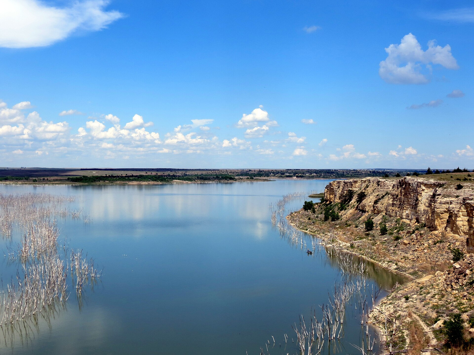
The destination brings together the Trego County Bluffton and Page Creek areas, Butterfield loops, camping, ramps and reservoir, with a representative land point chosen for local weather context.
Planning an Outing
Use the forecast to evaluate drought, low water, powerful wind, blowing dust, lightning, heat, wildfire and winter roads, then confirm the operating rule for the precise part of this the Trego County Bluffton and Page Creek areas, Butterfield loops, camping, ramps and reservoir you intend to use.
Destination-Specific Access
Biking stays on the marked 1.25-mile Butterfield and 0.5-mile Smoky Hill loops and roads, yielding to hikers. Coverage does not expand merely because the water boundary approaches another county.
Weather Tips
- Across the Trego County Bluffton and Page Creek areas, Butterfield loops, camping, ramps and reservoir, compare wind direction with open-water fetch; short, steep waves can build before rain arrives.
- For this the Trego County Bluffton and Page Creek areas, Butterfield loops, camping, ramps and reservoir, read the gauge trend and upstream rainfall because current and floating debris can change after local skies clear.
- Within the Trego County Bluffton and Page Creek areas, Butterfield loops, camping, ramps and reservoir, honor posted wet-trail closures and keep bicycles off hiking-only routes.
- Before camping at the Trego County Bluffton and Page Creek areas, Butterfield loops, camping, ramps and reservoir, confirm loops, water service and gate hours with the managing agency.
Nearby Towns and Areas
- Cedar Bluff State Park
- Bluffton Area
- Page Creek
- Butterfield Trail
Adjust the Day to the Forecast
Move to shore or a short protected trail when wind, waves, flow or access is unsuitable; otherwise, replace natural-surface riding with a paved route when trails are closed.
7-Day Forecast
Weather by Season
Winter
A mild afternoon can follow a hard freeze, leaving shaded ground icy and exposed soil soft while powerful wind changes; choose the route with the clearest exit.
Spring
Warm-sector humidity often arrives before hail or lightning while drought remains sensitive; use radar trends and leave exposed terrain early.
Summer
Thunderstorm outflow can arrive well ahead of rain and intensify low water, so leave open water, prairie or elevated ground when warnings approach.
Fall
Cold mornings, warm afternoons and leaf cover create different footing while wildfire and winter roads evolves; carry layers and set an early turnaround.
Key Climate Data Points
- Local climate: This local planning area has an annual average temperature near 55–57°F, receives roughly 24–31 inches of precipitation and records commonly 13–20 inches in the Western Kansas planning area near Cedar Bluff State Park.
- Wettest season: Late spring and early summer, when drought deserves extra attention.
- Driest season: Winter and late summer.
- Annual average temperature: Near 55–57°f.
- Annual snowfall: Commonly 13–20 inches for the local climate around Cedar Bluff State Park.