Today’s Forecast:
☁
66°F
High: 71°
|
Low: 57°
Current Temperature
Cloudy
⚠️
High Surf Advisory
High Surf Advisory issued November 12 at 11:49AM PST until November 13 at 9:00PM PST by NWS Los Angeles/Oxnard CA (Expires: November 13, 2026 11:00 pm)
Show Alert Details & Instructions
Description:
* WHAT...For the High Surf Advisory, large breaking waves of 10 to
15 feet with dangerous rip currents. For the High Surf Warning,
dangerously large breaking waves of 18 to 25 feet with dangerous
rip currents. For the Coastal Flood Warning, significant coastal
flooding expected.
* WHERE...San Luis Obispo County Beaches and Santa Barbara
County Central Coast Beaches. Surf will we highest for west-
northwest facing beaches.
* WHEN...For the High Surf Advisory, until 9 PM PST Friday. For
the High Surf Warning, from 9 PM Friday to 3 AM PST Sunday.
For the Coastal Flood Warning, from 3 AM to 6 PM PST Saturday.
* IMPACTS...There is a high risk for flooding of sea water over
vulnerable low-lying coastal areas, especially around the time
of high tide. This includes significant flooding of coastal
beaches, walkways and roads, and potentially damaging some
structures. Significant beach erosion is expected. Powerful
waves and strong rip currents will pose an exceptional risk of
ocean drowning and damage to coastal structures like piers and
jetties. Large breaking waves can cause injury, wash people off
beaches and rocks, and capsize small boats near shore. Remain
far away from the water's edge.
* ADDITIONAL DETAILS...A series of west-northwesterly swells will
create an extended period of large surf into next week, with the
potential for WARNING level surf again late Sunday night through
Monday. Areas that may see most significant impacts will be
west-northwest facing beaches, with widespread flooding likely
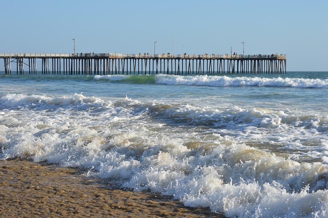
at Oceano Dunes. Breaking waves may impact the Cayucos and Pismo
Beach piers as well as the Morro Bay Harbor entrance.
Instructions:
Stay off of beaches and coastal walkways, roads, and structures.
Do NOT drive around barricades or through water of unknown depth.
Everyone should remain out of the water due to life-threatening
surf conditions. Stay off of jetties, piers, and other water side
infrastructure.
⚠️
High Surf Warning
High Surf Warning issued November 12 at 11:49AM PST until November 15 at 3:00AM PST by NWS Los Angeles/Oxnard CA (Expires: November 15, 2026 5:00 am)
Show Alert Details & Instructions
Description:
* WHAT...For the High Surf Advisory, large breaking waves of 10 to
15 feet with dangerous rip currents. For the High Surf Warning,
dangerously large breaking waves of 18 to 25 feet with dangerous
rip currents. For the Coastal Flood Warning, significant coastal
flooding expected.
* WHERE...San Luis Obispo County Beaches and Santa Barbara
County Central Coast Beaches. Surf will we highest for west-
northwest facing beaches.
* WHEN...For the High Surf Advisory, until 9 PM PST Friday. For
the High Surf Warning, from 9 PM Friday to 3 AM PST Sunday.
For the Coastal Flood Warning, from 3 AM to 6 PM PST Saturday.
* IMPACTS...There is a high risk for flooding of sea water over
vulnerable low-lying coastal areas, especially around the time
of high tide. This includes significant flooding of coastal
beaches, walkways and roads, and potentially damaging some
structures. Significant beach erosion is expected. Powerful
waves and strong rip currents will pose an exceptional risk of
ocean drowning and damage to coastal structures like piers and
jetties. Large breaking waves can cause injury, wash people off
beaches and rocks, and capsize small boats near shore. Remain
far away from the water's edge.
* ADDITIONAL DETAILS...A series of west-northwesterly swells will
create an extended period of large surf into next week, with the
potential for WARNING level surf again late Sunday night through
Monday. Areas that may see most significant impacts will be
west-northwest facing beaches, with widespread flooding likely
at Oceano Dunes. Breaking waves may impact the Cayucos and Pismo
Beach piers as well as the Morro Bay Harbor entrance.
Instructions:
Stay off of beaches and coastal walkways, roads, and structures.
Do NOT drive around barricades or through water of unknown depth.
Everyone should remain out of the water due to life-threatening
surf conditions. Stay off of jetties, piers, and other water side
infrastructure.
⚠️
Coastal Flood Watch
The Coastal Flood Watch has been replaced. Please see the latest information from NWS Los Angeles/Oxnard CA on this developing situation. (Expires: November 14, 2026 5:00 pm)
Show Alert Details & Instructions
Description:
The Coastal Flood Watch has been replaced. Please see the latest information from NWS Los Angeles/Oxnard CA on this developing situation.
Instructions:
Stay off of beaches and coastal walkways, roads, and structures.
Do NOT drive around barricades or through water of unknown depth.
Everyone should remain out of the water due to life-threatening
surf conditions. Stay off of jetties, piers, and other water side
infrastructure.
⚠️
Coastal Flood Warning
Coastal Flood Warning issued November 12 at 11:49AM PST until November 14 at 6:00PM PST by NWS Los Angeles/Oxnard CA (Expires: November 14, 2026 8:00 pm)
Show Alert Details & Instructions
Description:
* WHAT...For the High Surf Advisory, large breaking waves of 10 to
15 feet with dangerous rip currents. For the High Surf Warning,
dangerously large breaking waves of 18 to 25 feet with dangerous
rip currents. For the Coastal Flood Warning, significant coastal
flooding expected.
* WHERE...San Luis Obispo County Beaches and Santa Barbara
County Central Coast Beaches. Surf will we highest for west-
northwest facing beaches.
* WHEN...For the High Surf Advisory, until 9 PM PST Friday. For
the High Surf Warning, from 9 PM Friday to 3 AM PST Sunday.
For the Coastal Flood Warning, from 3 AM to 6 PM PST Saturday.
* IMPACTS...There is a high risk for flooding of sea water over
vulnerable low-lying coastal areas, especially around the time
of high tide. This includes significant flooding of coastal
beaches, walkways and roads, and potentially damaging some
structures. Significant beach erosion is expected. Powerful
waves and strong rip currents will pose an exceptional risk of
ocean drowning and damage to coastal structures like piers and
jetties. Large breaking waves can cause injury, wash people off
beaches and rocks, and capsize small boats near shore. Remain
far away from the water's edge.
* ADDITIONAL DETAILS...A series of west-northwesterly swells will
create an extended period of large surf into next week, with the
potential for WARNING level surf again late Sunday night through
Monday. Areas that may see most significant impacts will be
west-northwest facing beaches, with widespread flooding likely
at Oceano Dunes. Breaking waves may impact the Cayucos and Pismo
Beach piers as well as the Morro Bay Harbor entrance.
Instructions:
Stay off of beaches and coastal walkways, roads, and structures.
Do NOT drive around barricades or through water of unknown depth.
Everyone should remain out of the water due to life-threatening
surf conditions. Stay off of jetties, piers, and other water side
infrastructure.
This Afternoon:Mostly cloudy, with a high near 71. South wind around 10 mph.
Tonight:A chance of rain after 10pm. Mostly cloudy, with a low around 57. South wind 5 to 10 mph. Chance of precipitation is 50%. New rainfall amounts less than a tenth of an inch possible.
Friday:Rain. Cloudy, with a high near 67. South southwest wind 5 to 20 mph, with gusts as high as 30 mph. Chance of precipitation is 100%. New rainfall amounts between a quarter and half of an inch possible.
Today’s Report:
Not Recommended for hiking. High near 67°F. Rain forecast later today (97%). Breezy winds (20 mph).
-
Temp: Favorable conditions
-
Rain: Marginal weather factor
-
Wind: Marginal weather factor
-
Thunderstorm: Favorable conditions
-
Alert: Unfavorable weather factor
-
Alert: Unfavorable weather factor
⚠️ Active weather alerts affect this activity!
Tomorrow's Outlook:
Not Recommended
29/100
Not Recommended for hiking. High near 67°F. Low rain risk (3%). Light wind (10 mph).
Not Recommended for biking. High near 67°F. Rain forecast later today (97%). Breezy winds (20 mph).
-
Temp: Favorable conditions
-
Rain: Marginal weather factor
-
Wind: Marginal weather factor
-
Thunderstorm: Favorable conditions
-
Alert: Unfavorable weather factor
-
Alert: Unfavorable weather factor
⚠️ Active weather alerts affect this activity!
Tomorrow's Outlook:
Not Recommended
29/100
Not Recommended for biking. High near 67°F. Low rain risk (3%). Light wind (10 mph).
Not Recommended for camping. High near 67°F. Rain forecast later today (97%). Breezy winds (20 mph).
-
Temp: Favorable conditions
-
Rain: Marginal weather factor
-
Wind: Marginal weather factor
-
Thunderstorm: Favorable conditions
-
Alert: Unfavorable weather factor
-
Alert: Unfavorable weather factor
⚠️ Active weather alerts affect this activity!
Tomorrow's Outlook:
Not Recommended
29/100
Not Recommended for camping. High near 67°F. Low rain risk (3%). Light wind (10 mph).
About Pismo Beach
Pismo Beach & Oceano Dunes is an outdoor-planning page for Pismo shoreline, Grover Beach, and Oceano. It has a distinct purpose centered on marine fog, beach wind, sand, coastal camping, cold water, and traffic, with the forecast used to choose the safest and most comfortable version of the day.
Make the Most of a Pismo Beach & Oceano Dunes Day
Start by comparing conditions across Pismo Beach, Shell Beach, and the rest of the coverage area. Choose among hiking, biking, camping based on wind, precipitation, temperature, visibility, water or trail conditions, road access, smoke, and available daylight.
Weather Tips for Pismo Beach & Oceano Dunes
- Conditions around Pismo shoreline, Grover Beach, and Oceano can differ sharply from nearby towns; marine fog, beach wind, sand, coastal camping, cold water, and traffic are the main planning variables.
- For camping, confirm overnight lows, wind, precipitation, fire restrictions, campground access, and how quickly shelter or services can be reached.
- Cold ocean water, marine fog, swell, beach wind, and winter storms can matter even when the inland forecast looks mild.
- Crowds and parking can narrow the useful weather window, so arrive early and keep a lower-commitment nearby option.
Nearby Towns and Areas
This page covers Pismo shoreline, Grover Beach, and Oceano. It can also be useful when planning outdoor time near:
- Pismo Beach
- Shell Beach
- Grover Beach
- Oceano
- Oceano Dunes
- Dinosaur Caves
- Price Canyon
Plan Around the Conditions
Use the forecast to choose the best version of Pismo Beach & Oceano Dunes rather than forcing one itinerary. A shorter route, earlier launch, sheltered shoreline, lower-elevation trail, or town-based backup can preserve the day when conditions change.
7-Day Forecast for Pismo Beach CA
Pismo Beach & Oceano Dunes Weather by Season
Winter
At Pismo Beach & Oceano Dunes, winter is the main rainy season, with coastal storms, high surf, cold water, and slick bluff or dune trails. Road and campground checks become more important after strong systems.
Spring
Around Pismo shoreline, Grover Beach, and Oceano, spring is green and increasingly workable for trails, paddling, and biking, though wind and lingering showers can interrupt plans. Ocean water stays cold and afternoon breezes often strengthen.
Summer
For marine fog, beach wind, sand, coastal camping, cold water, and traffic, morning fog and marine layer are common near the shore, followed by brighter but often windy afternoons. Inland trailheads may be much warmer, so match the route to the local cloud cover and exposure.
Fall
Near Pismo Beach and the surrounding area, early fall can bring clear, mild coast days and lighter crowds, while later fall gradually reintroduces rain and stronger swell. Dry vegetation and wildfire smoke can affect inland-facing routes.
Key Climate Data Points
- Warmest months: September and October near the shore; midsummer farther inland.
- Coolest months: December through February.
- Wettest season: November through March.
- Driest season: July through September.
- Best outdoor window: Late spring and early fall for coastal trails, paddling, biking, and camping.