Today’s Forecast:
❄
36°F
High: 41°
|
Low: 35°
Current Temperature
Light Snow
⚠️
Winter Weather Advisory
Winter Weather Advisory issued November 13 at 3:47AM EST until November 13 at 1:00PM EST by NWS Gaylord MI (Expires: November 13, 2026 12:00 pm)
Show Alert Details & Instructions
Description:
* WHAT...Lake effect snow. Additional snow accumulations of one to
two inches, particularly in the higher terrain away from the
immediate lakeshores. Areas under the most intense snow bands could
see locally higher amounts. Less than an inch of snow is expected
in eastern Grand Traverse County.
* WHERE...Benzie, Grand Traverse, and Leelanau Counties.
* WHEN...Until 1 PM EST this afternoon.
* IMPACTS...Plan on sloppy, slippery road conditions. The hazardous
conditions will impact the Friday morning commute.
Instructions:
Slow down and use caution while traveling.
Be prepared for sloppy, slippery roads. Slow down and use caution
while driving. If you are going outside, watch your first few steps
taken on stairs, sidewalks, and driveways. These surfaces could be
icy and slippery, increasing your risk of a fall and injury. This is
particularly true of elevated surfaces such as decks or bridges.
During lake effect snow, the weather can vary from bands of locally
heavy snow to dry weather just a few miles away. Visibilities can
also vary greatly. Be prepared for rapid changes in weather,
visibility, and road conditions.
Today:Rain and snow showers likely. Mostly cloudy. High near 41, with temperatures falling to around 39 in the afternoon. North wind around 15 mph, with gusts as high as 25 mph. Chance of precipitation is 70%. New rainfall amounts less than a tenth of an inch possible.
Tonight:Rain showers likely before 7pm, then a chance of rain and snow showers between 7pm and 1am, then a slight chance of rain and snow showers. Cloudy. Low around 35, with temperatures rising to around 38 overnight. North wind around 15 mph, with gusts as high as 30 mph. Chance of precipitation is 60%. New rainfall amounts less than a tenth of an inch possible.
Saturday:A chance of rain and snow showers before 1pm. Cloudy. High near 43, with temperatures falling to around 41 in the afternoon. North wind around 15 mph. Chance of precipitation is 30%.
Today’s Report:
Good for hiking. High near 42°F. Low rain risk (29%). Light wind (15 mph).
-
Temp: Marginal weather factor
-
Rain: Favorable conditions
-
Wind: Favorable conditions
-
Thunderstorm: Favorable conditions
Tomorrow's Outlook:
Not Recommended
20/100
Not Recommended for hiking. High near 38°F. Low rain risk (5%). Temperatures outside comfort limits (38°F).
Good for camping. High near 42°F. Low rain risk (29%). Breezy winds (15 mph).
-
Temp: Marginal weather factor
-
Rain: Favorable conditions
-
Wind: Marginal weather factor
-
Thunderstorm: Favorable conditions
Tomorrow's Outlook:
Not Recommended
20/100
Not Recommended for camping. High near 38°F. Low rain risk (5%). Temperatures outside comfort limits (38°F).
Not Recommended for paddling. High near 42°F. Risk of rain later today (29%). Breezy winds (15 mph). Temperatures outside comfort limits (42°F).
-
Temp: Unfavorable weather factor
-
Rain: Marginal weather factor
-
Wind: Marginal weather factor
-
Thunderstorm: Favorable conditions
Tomorrow's Outlook:
Not Recommended
23/100
Not Recommended for paddling. High near 38°F. Low rain risk (5%). Temperatures outside comfort limits (38°F).
Use Caution for fishing. High near 42°F. Low rain risk (29%). Breezy winds (15 mph).
-
Temp: Marginal weather factor
-
Rain: Favorable conditions
-
Wind: Marginal weather factor
-
Thunderstorm: Favorable conditions
Tomorrow's Outlook:
Not Recommended
22/100
Not Recommended for fishing. High near 38°F. Low rain risk (5%). Temperatures outside comfort limits (38°F).
Fair for sledding / snowshoeing. High near 42°F. Low rain risk (29%). Breezy winds (15 mph).
-
Temp: Marginal weather factor
-
Rain: Favorable conditions
-
Wind: Marginal weather factor
-
Thunderstorm: Favorable conditions
Tomorrow's Outlook:
Excellent
86/100
Excellent for sledding / snowshoeing. High near 38°F. Low rain risk (5%).
About Sleeping Bear Dunes
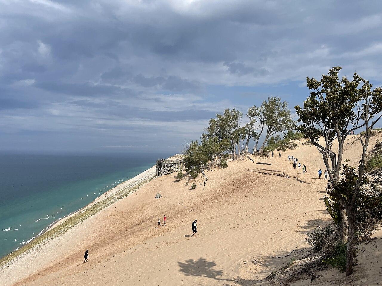
Sleeping Bear Dunes is one of Michigan’s signature outdoor destinations, with high dunes, Lake Michigan beaches, overlooks, campgrounds, inland lakes, and trail systems spread across a large national lakeshore landscape. Conditions can vary sharply between the lakefront, dune climbs, shaded woods, and inland access points. A good forecast check includes wind, heat, storms, wave conditions, and how much exposed sand hiking your group can comfortably handle.
Make the Most of a Sleeping Bear Dunes Day
Plan the most exposed dune climbs, overlooks, and beach walks for cooler or calmer parts of the day. If heat, wind, or storms increase, shift to shaded trails, scenic drives, visitor center stops, or inland lake plans. Paddling and beach choices should follow wind direction and wave conditions rather than the general sky forecast.
Weather Tips for Sleeping Bear Dunes
- Dune hiking is exposed and can feel much hotter and harder than wooded trail mileage.
- Lake Michigan waves and currents can make swimming or paddling unsafe even on clear days.
- Storms and fog can reduce visibility at overlooks and create fast-changing shoreline conditions.
- Campground nights can cool down quickly near the lake, even after warm afternoons.
Plan Around the Conditions
Use the forecast as a way to choose the best version of Sleeping Bear Dunes, not as a simple yes-or-no answer. Match the wind, rain timing, temperature, and water or trail conditions to the activity that gives your group the safest and most comfortable day.
7-Day Forecast for Sleeping Bear Dunes