
Manasquan Inlet, NJ
Today’s Forecast:
Show Alert Details & Instructions
Today’s Report:
Boating
Not Recommended for boating. High near 50°F. Rain forecast later today (90%). Breezy winds (15 mph). Temperatures outside comfort limits (50°F).
- Temp: Unfavorable weather factor
- Rain: Marginal weather factor
- Wind: Marginal weather factor
- Thunderstorm: Favorable conditions
Paddling
Not Recommended for paddling. High near 50°F. Rain forecast later today (90%). Breezy winds (15 mph). Temperatures outside comfort limits (50°F).
- Temp: Unfavorable weather factor
- Rain: Marginal weather factor
- Wind: Marginal weather factor
- Thunderstorm: Favorable conditions
Fishing
Use Caution for fishing. High near 50°F. Rain forecast later today (90%). Breezy winds (15 mph).
- Temp: Marginal weather factor
- Rain: Marginal weather factor
- Wind: Marginal weather factor
- Thunderstorm: Favorable conditions
Outdoor Events / Activities
Use Caution for outdoor events / activities. High near 50°F. Rain forecast later today (90%). Breezy winds (15 mph).
- Temp: Marginal weather factor
- Rain: Marginal weather factor
- Wind: Marginal weather factor
- Thunderstorm: Favorable conditions
About Manasquan Inlet, NJ
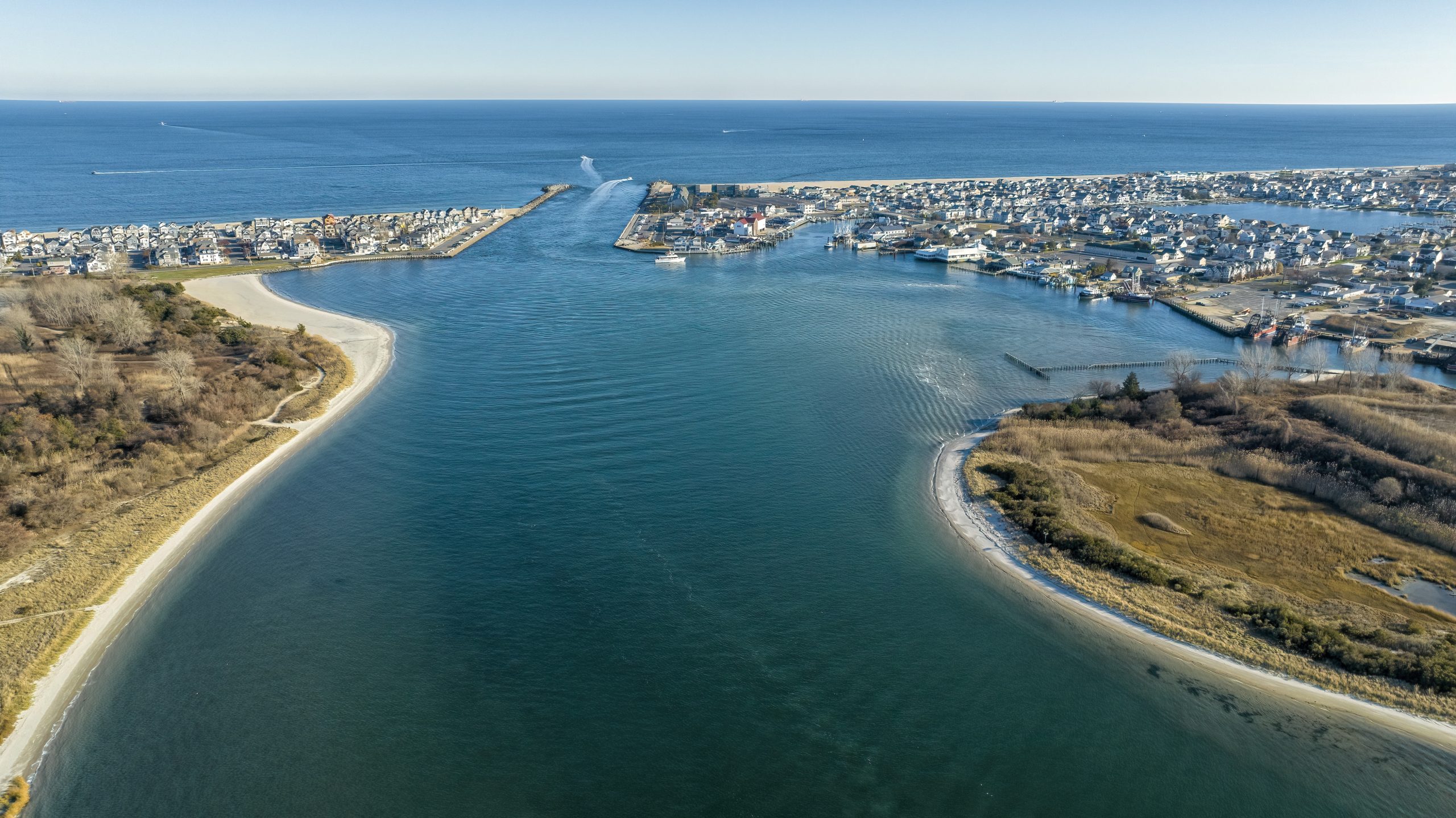
Manasquan Inlet rewards weather-aware planning with jetties, a busy navigation channel, marinas, fishing access, surf, and the river mouth.
Planning an Outing at Manasquan Inlet
Put the most exposed or time-sensitive activity first, then keep a shorter option nearby if wind, rain, heat, or access changes.
Weather Tips for Manasquan Inlet
- Review tides, surf, rip-current guidance, marine wind, fog, water temperature, and small-craft conditions before beach or water plans.
- Confirm lifeguard schedules, beach badges or entry controls, parking, wildlife closures, ferry or launch status, and storm-related access changes.
- Sea breeze can disguise heat while onshore storms or lightning still require a quick exit from beaches, boardwalks, marinas, and open water.
- Nor’easters, tropical systems, king tides, and erosion can alter access even after the worst weather has passed.
Nearby Towns and Areas
Use this forecast as practical context for outdoor plans near:
- Manasquan
- Brielle
- Point Pleasant
- Manasquan River
- Fisherman’s Cove
- Glimmer Glass
Adjust the Day to the Forecast
Keep the main objective flexible; a shorter route or later start is often the better choice when access or weather is uncertain.
7-Day Forecast for Manasquan Inlet
Manasquan Inlet Weather by Season
Winter
Winter at Manasquan Inlet is quieter but exposed to nor’easters, strong coastal wind, flooding, and occasional snow or ice. Ocean and tidal water remain dangerously cold, and services or guarded access are limited.
Spring
Spring alternates between mild afternoons and raw onshore flow. Cold water, fog, rip-current or inlet conditions, and limited lifeguard coverage require more caution than the air temperature suggests.
Summer
Summer brings warm beach weather along with humidity, sea breezes, crowded access, and fast-moving thunderstorms. Check surf, rip currents, tide, heat index, and swimming or launch status before leaving. Tide against wind can steepen inlet chop quickly, so paddlers and boaters need a route-specific marine check.
Fall
Fall often offers warm water and lighter crowds, but tropical systems, nor’easters, king tides, erosion, and earlier darkness can change shoreline access quickly.
Key Climate Data Points
- Annual average temperature: about 54–57°F using nearby coastal climate stations.
- Annual snowfall: usually about 10–20 inches near the coast, although individual nor’easters can produce much more.
- Warmest months: July and August are normally warmest.
- Coolest months: January is typically coolest.
- Wettest season: Summer is often wettest because of thunderstorms and tropical moisture, although precipitation is distributed through the year.
- Driest season: Fall is often driest, particularly from October into November.
- Best outdoor window: Late spring through early fall, adjusted for surf, water temperature, and guarded access.