
Hurricane Ridge, WA

Today’s Forecast:
🧐 Adventure Bingo Game
Download the outdoor adventure Bingo game to keep kids engaged in the outdoors.
Today’s Report:
Hiking
Ideal conditions for hiking. Comfortable temperature (high near 46°F), light wind, and clear forecast.
- Temp: Marginal weather factor
- Rain: Favorable conditions
- Wind: Favorable conditions
- Thunderstorm: Favorable conditions
Outdoor Events / Activities
Not Recommended for outdoor events / activities. High near 46°F. Temperatures outside comfort limits (46°F).
- Temp: Unfavorable weather factor
- Rain: Favorable conditions
- Wind: Favorable conditions
- Thunderstorm: Favorable conditions
Camping
Ideal conditions for camping. Comfortable temperature (high near 46°F), light wind, and clear forecast.
- Temp: Marginal weather factor
- Rain: Favorable conditions
- Wind: Favorable conditions
- Thunderstorm: Favorable conditions
About Hurricane Ridge
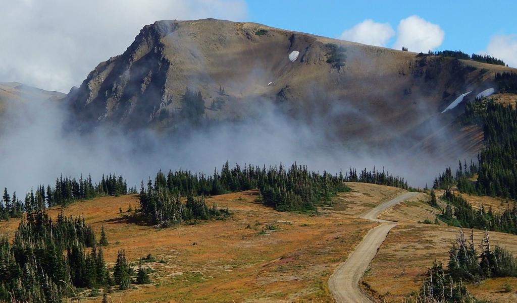
Hurricane Ridge is a Washington destination for the high-elevation road, alpine viewpoints, ridge trails, and winter-access corridor above Port Angeles.
Make the Most of a Hurricane Ridge Day
Check road access before climbing from the lowlands. Wind, clouds, snow, smoke, and visibility can change rapidly at ridge elevation.
Weather Tips for Hurricane Ridge
- Compare valley and high-elevation forecasts because snow, wind, clouds, smoke, and temperature can change sharply with elevation.
- If thunder is possible, finish exposed viewpoints, ridges, golf, or event grounds early and keep substantial shelter close.
- Check overnight lows, wet ground, fire rules, drainage, and the nearest substantial shelter before settling into camp.
- Summer smoke, winter access, shoulder-season closures, and shorter fall daylight can matter even during an otherwise mild forecast.
Nearby Towns and Areas
This page can also be useful when planning outdoor time near:
- Port Angeles
- Obstruction Point Road
- Elwha Valley
- Klahhane Ridge
- Olympic Mountains
- Lake Angeles
- Heart O’ the Hills
Plan Around the Conditions
Use the forecast to choose the best version of a Hurricane Ridge day. Match wind, precipitation, smoke, water conditions, trail surfaces, road access, temperature, and daylight to the activity that gives your group the safest and most comfortable plan.
7-Day Forecast for Hurricane Ridge, WA
Hurricane Ridge Weather by Season
Winter
Winter at Hurricane Ridge brings mountain snow, ice, short daylight, and changing road or trailhead access. Higher routes may close while lower valleys remain rainy, so check current transportation notices.
Spring
Spring around Hurricane Ridge brings changing conditions, rising rivers, wet trails, and lingering mountain snow. Give muddy natural surfaces time to drain and avoid widening trails. Mountain and eastern thunderstorms become increasingly possible later in the season.
Summer
Summer at Hurricane Ridge is usually the driest and most dependable season, but wildfire smoke, fire restrictions, heat, and afternoon thunderstorms can interrupt plans. Start exposed routes early and carry enough water. Dry vegetation makes local fire rules especially important.
Fall
Fall at Hurricane Ridge brings cooler temperatures, shorter daylight, changing color, and the return of wetter weather west of the Cascades. Early snow or ice may reach upper roads before lower elevations. Check seasonal facility hours and allow extra time on busy event or salmon-viewing weekends.
Key Climate Data Points
- Annual average temperature: generally around the upper 30s to low 40s at ridge elevation, using the relevant local or regional elevation context.
- Annual snowfall: often well over 100 inches, with large year-to-year variation, with substantial year-to-year and elevation variation.
- Warmest months: July and August are normally warmest.
- Coolest months: December through February are typically coolest.
- Wettest season: November through January.
- Driest season: July and August.
- Best outdoor window: July through September when the ridge road and alpine trails are normally most accessible.